Friday, May 29, 2009

Peru Bound: Puno and Lake Titicaca

After exploring the Bolivian side of Lake Titicaca, it was time to bid Bolivia goodbye. We boarded a bus that took the road up the south and west side of the lake to a town called Puno: our first stop in Peru. So far, Peru looks a lot like Bolivia. Women wander the streets in their multi-layered skirts and boler hats and handicrafts made of alpaca wool are sold everywhere.

From the port of Puno we took a little boat trip out to the floating islands of the Uros people. The islands are built using layers of buoyant totora reeds that grow in the shallows of the lake. The reeds are used to make their homes, boats, and crafts. The island reeds are constantly replenished from the top. In the wet season they replenish once per month and in the dry season (now) it is only necessary to do so every 2-3 months. Below is a model of a island village that our hosts built to show us how the islands and buildings are made.


We made our way through a river of the reeds to the group of 45 separate islands on the edge of the Puno Bay. Each island houses 5-8 families of 4 or 5 people each. They have houses and cooking spaces, and kitchen huts. They catch several different species of fish (including lake trout introduced from Canada!) for their own diet and to sell at the Saturday market in Puno. Tourism is also a necessary component to their survival and they warmely welcomed us to their island to show us thier way of life, clothes, and crafts.
This is the kitchen for the island we visited:

Some fish out drying so that they can take them into town to sell at the Saturday market:

The women of the island we visited signing us a departure song in the local language, Q´uechua


Boats made of reeds and shaped like pumas:


Peru Fun Fact:
At our first meal in Peru we noticed something noteworthy on the menu: the local specialty of cuy (guinea pig). We´ll let you know if we decide we are brave enough to try it!

Wednesday, May 27, 2009

Copacabana and Isla del Sol

From La Paz we bussed North West 3 hours to the small town of Copacabana. At 3800 metres above sea level, ¨Copa¨ is the jump-off point on the Bolivian side to explore the islands of Lake Titicaca. Lake Titicaca is one of the highest navigatable lakes in the world(some guidebooks suggest it is the highest in the world!). At 230 km long and 97 wide, Lake Titicaca stradles the border of Bolivia and Peru. After battling some belly issues, we were keen to be active again and get some hiking in as well as take in some of the gorgeous scenery of lake, mountains, and greenery of the region.

From Copa, we hiked along the dirt road 17 kilometres to the next town of Yampupata. Along the way we saw lots of trout fish farms lining the shores of the lake. There was hardly any traffic as we passed through several villages where the people always had a warm smile and an ¨buenos dias¨to greet us. The people here live simple lives, farming the fertile soil along the lake, fishing, raising sheep, and using donkeys as means to carry loads from one place to another.
We arrived at the port in Yampupata 4 hours later and hired a boat to take us over to the nearby Isla del Sol (Island of the Sun). Isla del Sol is the legendary Inca creation site and is the birthplace of the sun in Inca mythology. With a population of around 5000, Isla del Sol is dotted with several villages. The boat dropped us at the south-end of the island to the village of Yumani. We ate a well-deserved lunch of trout and hired some little niños (kids) to take us to the best hostel in the village. Up, up, and up we went passing donkeys coming down to gather goods from incoming boats. The niños took us to a great little hostel perched on the hill with an amazing view of the lake and the Cordillera Mountain range beyond. We dropped our stuff off and took off for another little walk to the top of the hill at the south end of the island. From there we watched fishing boats finish up their day as the sun dropped behind the mountains.
Up and at 'em early the next morning, our mission was to hike along the historic inca trail to the north end of the island in time to catch the only ferry from the back to Copa at 1.30. After some trouble finding the trail (and climbing a HUGE hill first thing in the morning- not an easy feat at 4000m above sea level) we were on the right track. We really could not have asked for a more amazing morning as we hiked along the ridge of the island, up and down a bit, through pastures where sheep grazed and passing farmers carrying loads of straw strapped to their backs.

As the sun climbed higher in the sky and the clouds cleared, we approached the Inca complex of Chincana, situated at the north end of Isla del Sol. We saw familiar constructions from Samaipata and the clues that this was indeed an Inca site, everything (windows, doors, mummy caves) carved and built from stone in 2`s, 4`s, or 8`s. We also saw the Titicaca Rock, which is the rock that the lake is named after. It means Grey Puma. The rock is definetely grey and apparently also looks like a puma, but we didn´t really see it. With a bit of imagination, the shape of the lake also looks like a puma when turned upside-down.


From the Chincana complex, it was a short walk down to the biggest town at the northern end of the island, Cha´llapampa. We had time for some lunch before boarding the boat back to the southern end of the island and then back to Copa. Back in Copa we stayed one more night before heading across the border to Peru to explore the Peruvian side of the lake and onwards into Peru.

Bolivia Fun Fact:
Bolivia has been a fantastic surprise for us and has lived up to its descriptions of being cold, warm, windy, steamy, dry, salty, and swampy. It is also very colourful; over 60% of the population of 8.8million claim indigenous heritage. Bolivia has it all...

Saturday, May 23, 2009

La Paz

From Rurrebenque, we had two options to make it to La Paz...
Option #1: 18-24hr overnight bus-ride on the worlds deadliest road (4000m elevation gain, 600m+ cliffs with no guard rails, 3.2 m wide dirt, potholed road that claims more than 100 lives a year).

Option #2: A short (35 minute) but exciting plane ride in an 18 passanger plane leaving from a grass airfield having to gain more than 6000m elevation in a very short distance to make it safely over the Andes Mountains and land in La Paz at 3660m.

We opted for the plane ride!

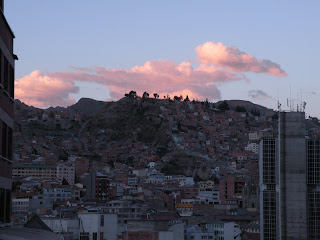
La Paz is an amazing city in many respects. The city´s buildings cling to the sides of a canyon and spill downwards. Recognized as the business centre of Bolivia, La Paz is a very lively and bussling place. Street vendors are set up 24 hours a day selling everything from food to furniture. From our hostel we were able to walk down to the famous Mercado de Hechiceria(Witches Market). The market is overflowing with herbs, magical potions and shriveled llama fetuses, which locals bury under the porches of their new homes for luck and fortune.


La Paz was a fun city and a great place to recover(bug bites, sun burn, food poisoning) from our Amazon trip. We even managed to catch an english speaking movie (Wolverine) at one of the local cinemas.

Thursday, May 14, 2009

Amazon Basin- Trinidad, Rurrenebaque

From Santa Cruz we made our way to Trinidad which was basically just a stopping-over point for us on the way to Rurrenbaque. From Trinidad we boarded a bus to Rurrenbaque in the Amazon Basin. Perhaps now is a good time to describe traveling by bus in Bolivia...
Most busses are over-used, run-down, and suffer break-downs regularily.
Most roads in Bolivia are not paved - even ones connecting major cities.
The altitudes in Bolivia vary dramatically between the highlands of the altiplano and the lowlands of the Amazon Basin which means that most roads are narrow switchbacks making their way up and down mountains. Typical busses(below) in Bolivia have high-clearance, knobby tires, and snorkles for their exhaust pipes so that they can cross smaller rivers.


We arrived in Bolivia at the end of the rainy season. Many roads in the Amazon Basin were still washed out which meant longer travel times. In many cases, where the roads were washed out, the busses would drive onto make-shift rafts propelled by dug-out canoes. Passengers on the bus were usually asked to exit the bus and stand on the raft - if the bus and raft went down you would have more of a chance to swim to safety.


Pampas(Amazon) Tour:
We arrived in the Amazon basin the small town of Rurrenbaque which is located on the Beni River. There are more than 60 tourism agencies in town so it took us a while to decide upon an agency and tour. We finally decided upon a 3 day tour of the pampas. We would visit the newly protected Pampas Del Yucama, a 616,000 ha protected area. The Pampas Del Yucama is part of an extensive fluvial plan of the Amazon Basin characterized by flooded savannas and jungle vegetation and wildlife.
We headed up the Beni river in a small 9 passenger boat with our tour guide Negro and 6 other trekkers. Negro was quite a character and had lost his index finger too an Alligator. Our accomodations for the tour were small cabins on the rivers edge, elevated on stilts, complete with bunks and mosquito nets. Almost right away we were amazed at the biodiversity and variety of species found along the river. Some of the wildlife we were able to view included 3 toed sloths, cappybearas, anacondas, and a variety of other species shown below.
Parrots flying over-head(above). It was a birders paradise along the river and we were lucky enough to see a large variety of birds including herons and many different species of eagles.
Squirrel monkey checking us out(above). We were lucky enough to see 5 different species of monkeys including howler monkeys. In the morning we could hear the low growl of the howler monkey. The growl sounds similar to a lion and is meant to make other howler monkeys aware of its territory.
A squirrel monkey feasting on a banana the guide negro placed on Chris´ head(below).
Our days consisted of motoring up and down the rivers viewing wildlife. There were many alligators along the way, often basking on the muddy shores of the river. This alligotor(below) had just entered the river after we boated up to it for a closer look.
An alligator hanging out in the sun by one of the river eco-lodges(below).
We were suprised and amazed to learn that the Beni river and many other headwaters of the Amazon are home to pink river dolphins. Getting a good picture of a dolphin is just as hard as getting a picture of a whale - ofter you just get the a ripple of water or the spout as they surface for air.
Rebecca enjoying a refreshing dip in the river and treading water in the river(below), waiting for a river dolphin(hopefully not an alligator) to tap her on the bottom of her feet.

Sunrise in the Pampas.

Inca Ruins & Cloud Forrest of Samaipata

Santa Cruz is humid! We have come down from the elevation (to 415 metres) for a breath of low-altitude air, if only for a day. Santa Cruz is a big city (1.2 million) and was really only a stopover for us to have a sleep in a proper bed after thenight bus, shower, grab a jar of peanut butter and continue on. We are a fan of the smaller towns so the next day we caught a shared taxi up, up, up, and up a winding road to Samaipata. The taxi we ended up in was originally an right-hand drive vehicle that had been converted over to a western left-hand drive. The steering wheel came out of the glove-box, and amazingly the original guages seemed to still work(one of the few vehicles in Bolivia with working instruments).
In Samaipata we relaxed back into the small-town way of life, browsing the few shops and restaurants, reading in the central plaza, and shopping for different tours and tour-guides.
We visited the pre-inca site of El Fuerte which is set spectacularily on a hilltop. We opted for a guided tour of the site and were richly rewarded with a very knowledgable and entertaining storyteller named Marten from Holland. He made up one of three amigos who own and operate The Roadrunners, a travel agency that runs guided tours through-out South America. He informed us what was known about the original coyo moya culture that created the site, and also how the inca culture took over the site and re-shaped much of it too fit with their own beliefs. There is still much that is unknown about the site but many books with wildly different theories (alien spaceships, etc.) have been written. The site was buried until about 30 years ago when it was discovered and uncovered. While the site is now quardened off so that people can not step on it, the weather is quickly eroding the sand-stone and many of the carvings and symbols which are already fading may entirely dissappear in the next 20 years unless a solution for preservation is found.
In the picture(below) you can make out 8 large rectangular doors that have been cut out of the rock. The number 8 is important in inca culture. The doors were carved out of the rock and people who died were placed into the doors. The doors are located in a way that they get maximum sun exposure and wind and once the bodies were naturally mummified they were ready for the after-life. The bodies were then placed in barrels and buried nearby. Several of the chambers have small holes drilled into them deep into the rock. The holes were created in hopes of being able to catch a glimpse at the after-life.


From Samaipata we boarded a local toor truck and made our way to the near-by Parque Nacional Amboro. The national park is made up of a mountain range that seperates the amazon basin(lowlands) from the altiplano region(highlands). This transitional zone is extremely diverse and more species of birds visit and live in this park than all of North America.

The park is visited a cloud rain-forest with giant tree ferns whose species date back more than 140 million years and are thought to have made up approximately 60% of the dinosaurs diets.


Cattle roam in pastures that are nearby the park and sometimes wonder in. This skull is from a steer that was killed by a puma five years earlier. The Puma killed 3 head of cattle in one week and then dissappeared into the thick jungle. Our hike started in in a lush and dense rain/cloud-forest. We emerged from the lush forest and made our way above the tree-line to the summit of the cloud-forest which was, of-course, enshrouded in clouds!


Breathless in Potosi & Lounging in Sucre

Potosi is the world´s highest city at a breath-taking 4060 m. After being founded in 1545, Potosi quickly grew and became world-known for having the most lucrative silver mines. By the end of the 18th century it had grown to be the larges and wealthiest city in Latin America. Unfortunately, much of the history of the mine should not be celebrated as millions of indigenous people and African slaves were conscripted to work in the less the ideal mines - the mines have actually cost millions of lives. The mines in Potosi are the longest running and largest silver mines in the world. The thing most travelers do in Potosi is go for a tour of the still-active mines, which reportedly still employ child labour in less than ideal conditions - we opted not to go for a tour. Instead we slowly navigated the hills of the city and took it easy at such high elevation, just taking it all in.

From Potosi we caught a ride in a shared-taxi 3 hours North East to Sucre. It was a winding road down but a good ride in Bolivian standards as the road was almost entirely paved! Amazing scenery and greenery greeted us on the ride to lower elevations.

Amazing historic buildings and street markets teeming with whatever you might need, Sucre is the judicial capital of Bolivia and was declared a Unesco Cultural Heritage site in 1991. We frequented the market and especially loved all the fresh fruit and smoothies that we available. Sucre is at 2750metres and is surrounded by beautiful green valleys and has a better climate for fruit productions, yum!

We took the opportunity to lounge a bit it Sucre to catch up on some sleep and give our aching bellies some attention. The city lends itself well to R&R with sunny warm days and cool nights and plenty of plazas to sit in and read or people watch.


Next stop: Santa Cruz and the cloud rainforest of Samaipata for some hiking and sight-seeing.

Bolivia Fun Fact:
There are lots of alpaca and llamas in Bolivia. This means lots of toques, mitts, scarves, socks, and sweaters for sale. Instead of spreading out, we often find these sorts of shops all huddled together on one street. We find similar streets lined with silver vendors (necklaces, rings, earings, etc), or fruit vendors, or toiletries stalls, or snack shops. While we appreciate the competition, the fact that they are all selling the same things leaves us wondering...how does anyone stand out and make money? How do we choose who to buy from?

Tuesday, May 5, 2009

Giddy Up in Tupiza!

From Uyuni we got on what´s left of Bolivia´s railway system for a train ride 5 hours south to Tupiza. Set at 2950 metres aboce sea level, Tupiza is surrounded by the rainbow-coloured rocks, hills, mountains, and canyons of the Cordillera de Chicas. It is also on the trail of Butch and Sundance, where the two are disputedly thought to have met there fate.

The first day we took it easy and checked out the clay courts at the local tennis club. We booked a time with one of the staff there and returned in the afternoon for some rallying and to have a match with our host. He ended up kicking Chris´ butt in the match, but Chris thinks the altitude has something to do with it! We had a great time and it was fun to chat with someone local and practice our spanish.

The next day we decided to explore the amazing surrounding landscapes on horseback with a local guide. We doned leather gaitors and straw hats and set out for a half-day exploring the countryside. Our guide took us on an amazing loop where we enjoyed the following:


After a tiring day with the horses we boarded an overnight bus to Sucre. But before we boarded the bus we waited in the cold at the station as it was an hour and a half late getting there. When it did arrive it was mostly full of a noisy, rambuctous, travelling Bolivian basketball team. And this was no ordinary bus; this bus was equipped to handle some off-roading. And off-roading we did...dirt road, potholes, dusty....ah, such is life traveling in Bolivia- an adventure!
Bolivia Fun Fact:
Honking is a way of life in Bolivia. There seem to be very few street lights. When approaching an intersection, drivers honk and hope that no one else is coming from any other direction!